In the realm of precision farming, the quest for accuracy is paramount. For years, real-time kinematics (RTK) has been a cornerstone technology, providing the centimeter-level accuracy necessary for tasks ranging from automated steering to precise planting. However, its inherent reliance on the proximity and operational status of a base station (or base stations) can present limitations, and this is where precise point positioning (PPP) technology comes into play.
In this article, CHCNAV will delve into the intricacies of PPP in precision farming, exploring its capabilities, advantages, applications, and how it compares to other positioning technologies.
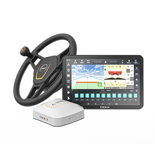
CHCNAV NX612 supports multiple GNSS and PPP modes
Limitations of Traditional GNSS and Demands of Modern Farming
Traditional standalone GNSS (like GPS and Galileo) provides meter-level accuracy, which, while sufficient for basic navigation, falls short of the stringent requirements of modern precision farming. Tasks like automated steering, precise planting, and variable rate application demand significantly higher levels of positioning accuracy to avoid overlaps, skips, and inefficient resource utilization.
With increasing demands for efficiency, sustainability, and resource optimization, farmers need positioning systems that offer greater precision and reliability. This paves the way for technologies like precise point positioning to play a more promine
What is PPP (Precise Point Positioning)?
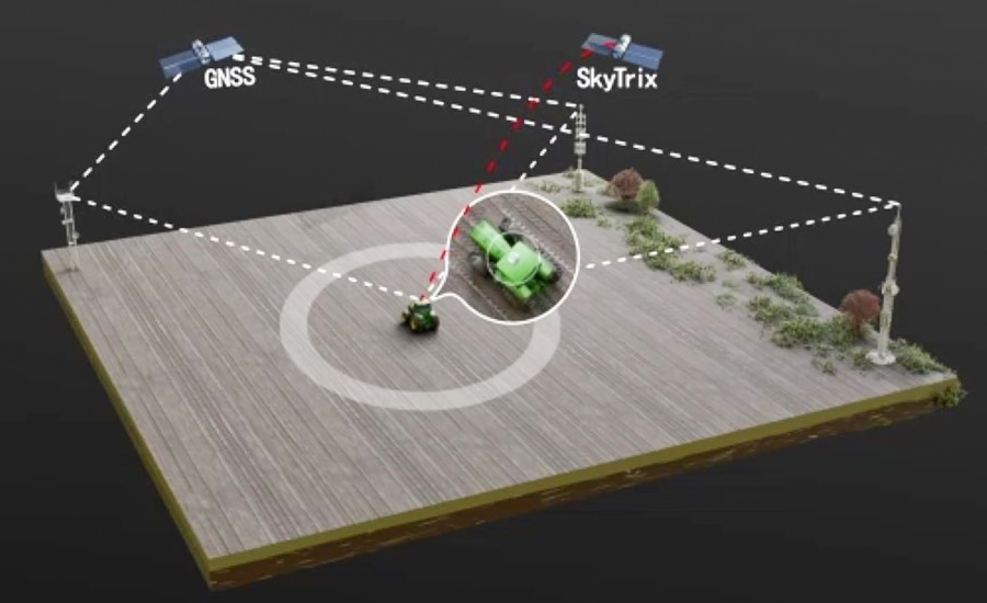
Precise Point Positioning (PPP) is a GNSS-based technology that enhances the accuracy of positioning by using correction data from a global network of reference stations. Simply put, PPP works by leveraging correction data that accounts for satellite orbit and clock errors, and atmospheric delays. This data is broadcast to users via satellite or the internet, allowing GNSS receivers to achieve high-precision positioning.
Unlike RTK, which requires a local base station, PPP can operate globally without the need for a nearby reference station and only involves a GNSS receiver. This makes it particularly useful in remote areas where setting up a base station is challenging. Furthermore, there are two main types of PPP services:
- Free PPP Services: Systems like BeiDou's B2b and Galileo's High Accuracy Service (HAS) provide open-access corrections, delivering accuracy levels of around 10 centimeters. While free, they come with longer convergence times, meaning users must wait multiple minutes for the system to achieve optimal accuracy.
- Paid PPP Services: Services like Trimble's RTX and the PointSky from CHCNAV offer higher accuracy, down to 2.5 centimeters. These paid services also provide faster convergence times—in as little as 30 seconds—making them suitable for applications requiring immediate high precision.
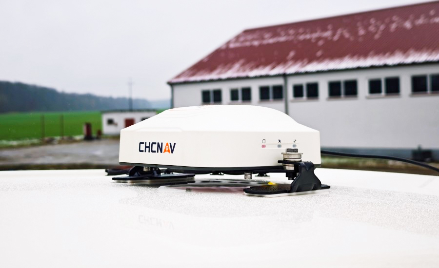
CHCNAV’s PointSky service
Advantages of PPP in Precision Farming
PPP offers a range of significant advantages that make it an increasingly attractive option for precision farming applications:
- High Accuracy: As discussed, PPP can achieve centimeter-level accuracy, meeting the demanding requirements of most precision agriculture tasks.
- Wide-Area Coverage: PPP corrections are delivered via satellite, providing global or regional coverage that is not limited by the distance to a base station. This makes PPP ideal for large, remote, or infrastructure-poor areas.
- No Base Station Requirement: Eliminating the need for setting up and maintaining local base stations simplifies operations, reduces infrastructure costs, and enhances flexibility, especially in remote or challenging terrains.
- Scalability: PPP solutions can be easily scaled across large fleets of agricultural machinery without the logistical complexities associated with managing multiple base stations.
- Post-processing and Real-time Options: PPP data can be used for both real-time kinematic positioning (with a data link for receiving real-time corrections) and post-processing applications, providing flexibility for various farming workflows.
Applications of PPP in Precision Farming
With the above advantages, what can precise point positioning do for you in precision farming? Here is a brief overview:
- Automated Steering and Guidance: PPP enables automated steering systems to achieve high-precision navigation, ensuring that farming vehicles follow optimal paths with minimal deviation. This reduces overlap and improves efficiency.
- Precise Planting and Seeding: With PPP, planting and seeding operations can be carried out with pinpoint accuracy. This ensures that seeds are planted at the optimal spacing and depth, maximizing crop yield and reducing seed waste.
- Soil Mapping and Analysis: PPP also enhances soil mapping and analysis by providing accurate positioning data. This enables farmers to create detailed maps of soil properties, enabling targeted soil management practices.
- Variable Rate Application of Inputs: By integrating PPP with sensor data and prescription maps, farmers can apply inputs (like fertilizers, seeds, and pesticides) precisely where and when they are needed, optimizing resource use and minimizing environmental impact.
- Autonomous Machinery: As the adoption of autonomous tractors and robots increases, PPP provides the reliable and accurate positioning necessary for safe and efficient operation.
- Yield Monitoring and Mapping: PPP aids in yield monitoring and mapping by providing accurate positioning data for sensors and monitors. This allows farmers to identify areas of high and low productivity, informing future management decisions.
- Precision Land Leveling: PPP also helps precision land leveling, ensuring that fields are leveled accurately to optimize water distribution and reduce runoff. This helps in conserving water and improving overall field productivity.
PPP vs. Other Positioning Technologies in Precision Farming
You may better comprehend how different positioning technologies aid your farming operation by understanding how precise point positioning compares to other key positioning technologies.
- PPP vs. RTK: While both PPP and RTK achieve centimeter-level accuracy, they have distinct differences. RTK provides real-time cm-level accuracy but requires a local base station, limiting its use in remote areas. PPP, on the other hand, offers wider area or global coverage without the need for a base station but may have slightly longer convergence times.Furthermore, the cost of RTK can include the purchase and maintenance of a base station or subscription fees for NRTK services. PPP often involves subscription fees for the correction service. Free PPP options exist but may have limitations in accuracy and convergence time.
- PPP vs. SBAS (Satellite-Based Augmentation Systems): Satellite-Based Augmentation Systems (SBAS), like WAAS serving the US and EGNOS operating in Europe, can achieve sub-meter accuracy and are suitable for applications that do not require the high precision of PPP or RTK. PPP offers higher accuracy and more consistent performance, making it a better choice for precision farming tasks that demand centimeter-level precision.
Below is a comparison table that will help you clearly identify the differences among the three technologies.
| Feature |
RTK |
PPP |
SBAS |
| Accuracy |
cm-level |
cm-dm level |
dm-m level
|
| Coverage |
Limited to base station range |
Regional/global
(satellite-based)
|
Regional |
| Base Station Needed |
Yes |
No |
No |
| Convergence Time |
Seconds–minutes |
Minutes (varies by service) |
Minutes |
| Cost |
Comparatively higher
(infrastructure, subscription)
|
Free (some services) or subscription |
Free |
| Scalability |
Limited by base station |
Unlimited |
Unlimited |
| Typical Use |
High-precision |
local operations |
Wide-area |
| Cases |
remote operations |
General |
guidance |
Note that there is PPP-RTK technology that combines both PPP and RTK techniques to achieve high-precision positioning with improved efficiency and reliability.
CHCNAV: Empower Precision Farming with High-Precision Auto-Steering Solutions
CHCNAV is a leading provider of precision agriculture solutions, offering advanced GNSS-based systems for automated steering, guidance, and farm management. Take our NX612 Automated Steering System as an example.
CHCNAV NX612 on farming machinery
This automated steering system delivers ±2.5 cm accuracy at speeds from 0.1 to 30 km/h, supporting a wide range of agricultural vehicles and operations. It ensures high positioning accuracy by supporting multiple GNSS modes, including RTK, E-PPP, H-PPP (using Galileo HAS), and PointSky, which is CHCNAV's own satellite-based PPP service capable of offering cm-level accuracy within a 5-minute convergence.
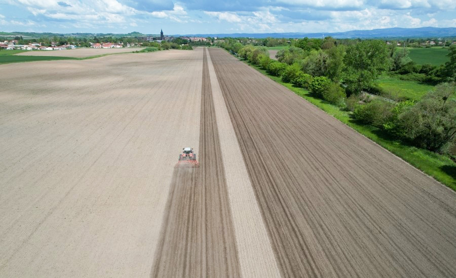
In other words, the CHCNAV NX612 Automated Steering System delivers consistent accuracy of ±2.5 cm even in areas without network coverage, making it ideal for large or remote farms where traditional RTK infrastructure may be lacking.
Conclusion
Precise point positioning is reshaping the future of precision farming by delivering high accuracy, scalability, and flexibility without the need for local base stations. Whether through free services like BeiDou B2b and Galileo HAS or advanced commercial offerings, PPP empowers farmers to achieve more with less—improving yields, reducing costs, and supporting sustainable agriculture.
CHCNAV stands at the forefront of this revolution, providing innovative auto-steering and guidance solutions powered by GNSS PPP technology. Furthermore, we commit to improving our products by making them more accessible and practical for farmers worldwide. Click here to contact CHCNAV today and discover how CHCNAV can empower your farm with the precision needed for a more efficient and profitable future!
____
About CHC Navigation
CHC Navigation (CHCNAV) develops advanced mapping, navigation and positioning solutions designed to increase productivity and efficiency. Serving industries such as geospatial, agriculture, construction and autonomy, CHCNAV delivers innovative technologies that empower professionals and drive industry advancement. With a global presence spanning over 140 countries and a team of more than 2,000 professionals, CHC Navigation is recognized as a leader in the geospatial industry and beyond. For more information about CHC Navigation [Huace:300627.SZ], please visit: www.chcnav.com